Sivas Kizilirmak Bridge
Sivas Kizilirmak Bridge
The proposed bridge design for the "Sivas Municipality Kızılırmak Bridge National Architectural Project Competition" is strategically situated at the intersection of Sivas City Center and Cumhuriyet University, where Recep Tayyip Erdoğan Boulevard spans the Kızılırmak River. The primary transportation axis, falling within the competition's scope and located between Junctions 1 and 2 of the new urban plan, facilitates not only vehicular traffic but also integrates a rail transit line, pedestrian pathways, and cycling routes. This multifaceted transport corridor underscores its functional and quantitative significance, particularly as it fosters organic growth of the city center and subsequently enables the establishment of Cumhuriyet University on the river's opposite bank. This axis traverses a qualitatively undefined yet vital area, serving as a bridge between the emergent urban spaces. The envisioned bridge is not merely a structural element; it is envisaged as a social connector, embodying the cultural fabric of the city and fostering interaction within its interface.
Sivas Kizilirmak Bridge
Context
In the context of a continental climate, the environmental conditions in Sivas significantly influence user ergonomics and responses. The compact and sheltered locations of urban attractions have shaped the emergence of residential areas. Cumhuriyet University, unable to fulfill its spatial needs within the city center, has established itself across the Kızılırmak River, gradually developing satellite units organized in a radial geometry. This phenomenon, evolving independently of user and designer initiatives, has resulted in the formation of diverse focal points within the city. Consequently, a transport axis has emerged that, while frequently traversed, remains underutilized spatially by urban users. The variable floodwaters of the Kızılırmak River have prevented consistent habitation along the riverbank, simultaneously acting as a countermeasure against human-induced habitat degradation and contributing to the river's sustainability.
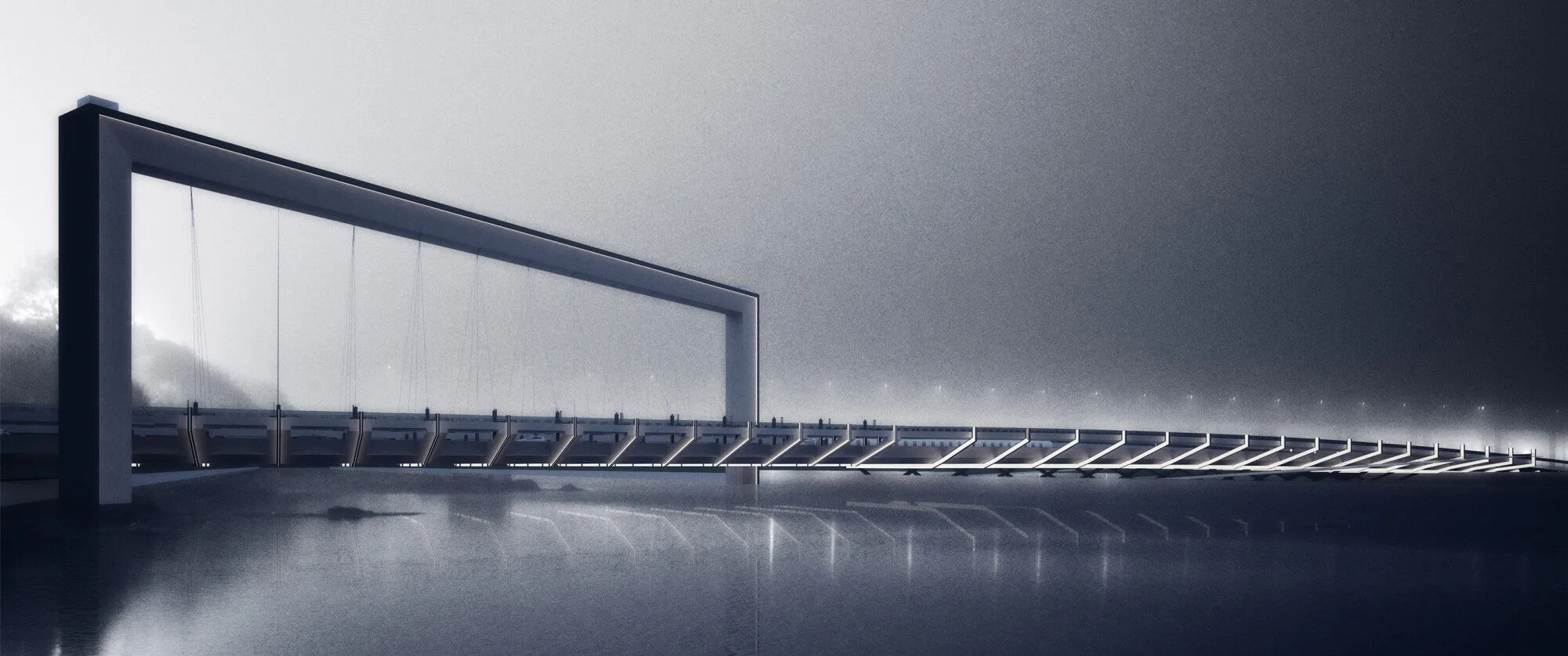
In light of these dynamics, the new urban regulations aim to transform the previously mentioned "undefined area" into a structured environment that enhances the urban attraction potential, focusing on radial rather than point-like geometry.
The visual interplay between the city center, represented by the Sivas Congress Hall and Sivas Castle, and the university, embodied by the Urban Forest, manifests as an interface along the waterway that facilitates a rich array of perspectives. Thus, the "City Center" is positioned as a highlighted element within a metaphorical frame for the "University," while the "University" similarly offers a contour that defines a potent view for the "City Center." Although this framework may seem to abstract the surrounding settlements from one another, its permeable nature integrally connects them, fostering community interactions. The obligatory convergence induced by the main transport route will, therefore, engrave itself within the collective memory of the city, enhanced by the river's habitat and diverse scenic qualities. Drawing upon the rich historical narrative of Sivas, the design is committed to incorporating contemporary technologies while preserving the essence of the city’s past. The proposed Kızılırmak Bridge transcends mere passage; it fosters social engagement through its interface with the urban landscape, boasting a permeable and flexible structural typology that seamlessly integrates sustainable landscape features, thereby accommodating the needs and desires of users at all hours.
Design
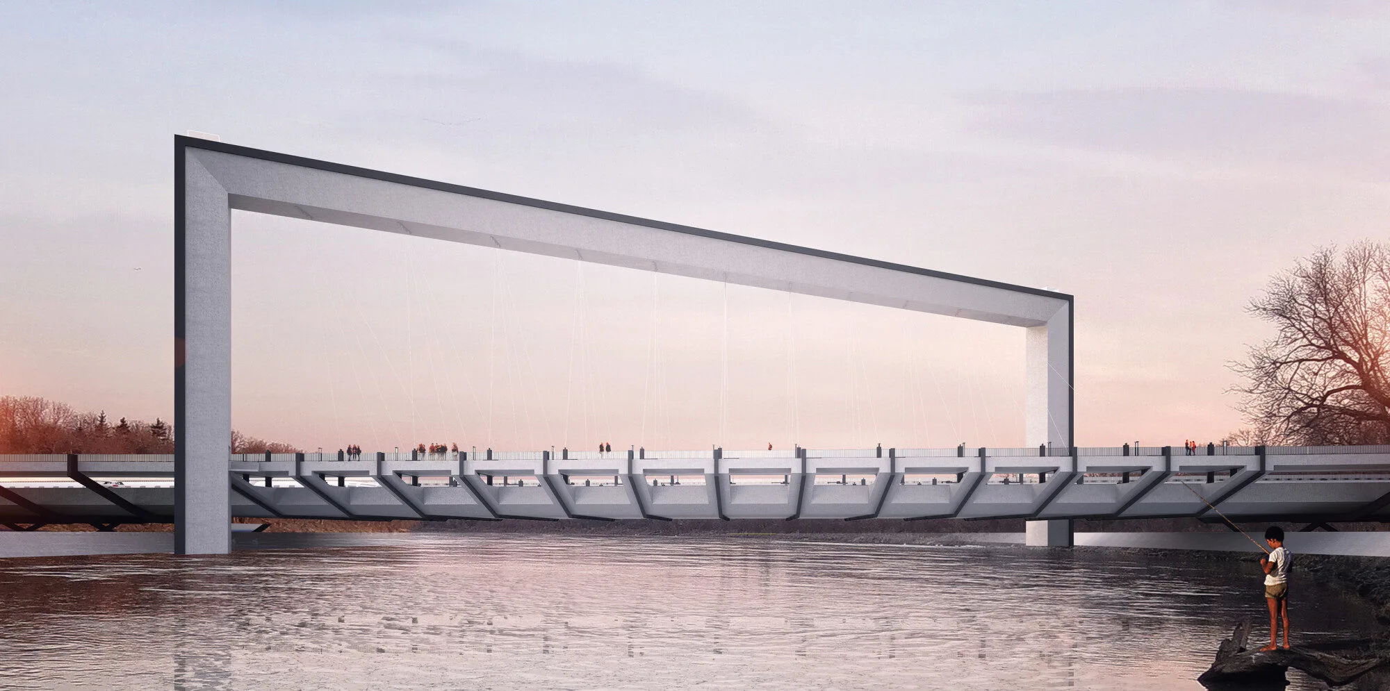
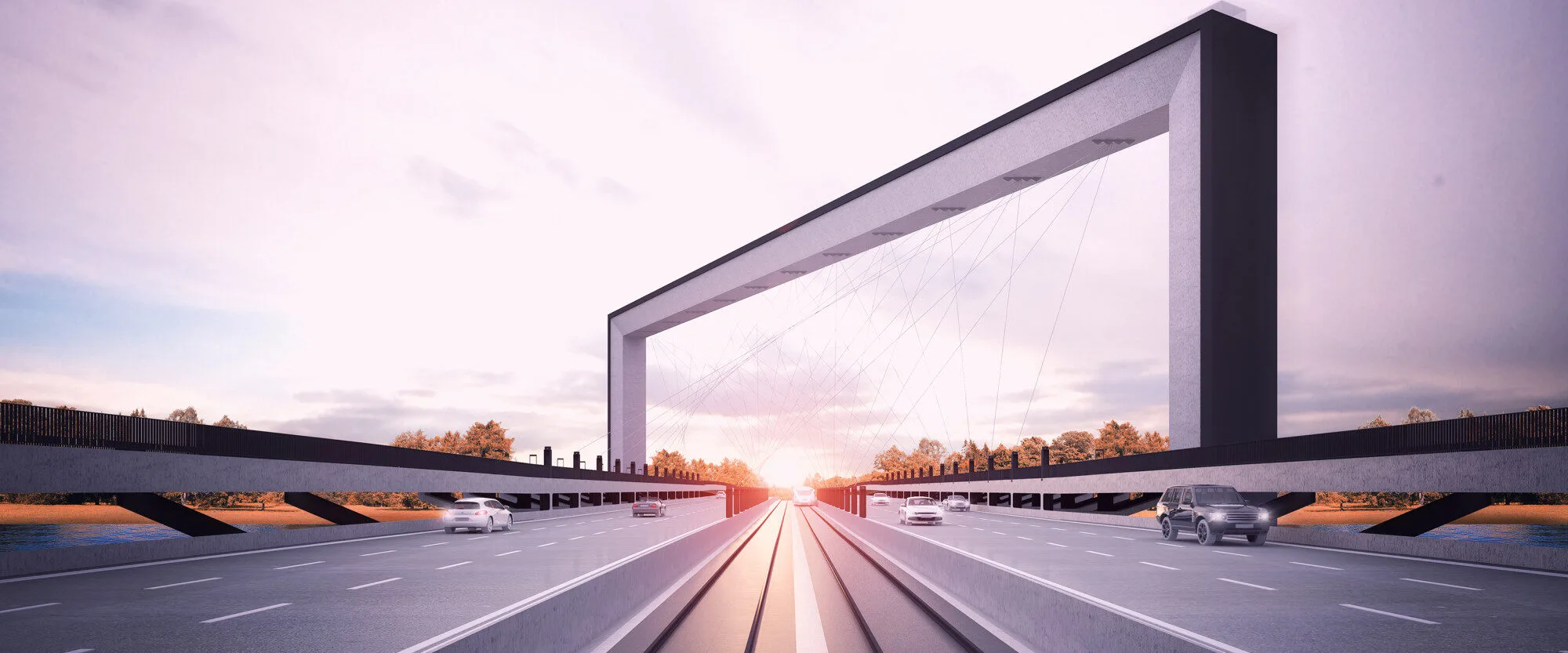
At the core of the structure lies a composite load-bearing framework constructed from high-performance concrete and steel methodologies, creating an evocative architectural identity. This framework not only delineates the vistas but also accommodates the bridge deck, directing the gaze of drivers and pedestrians toward intentionally framed focal points along the horizon. The perceptual frame is strategically positioned for easy recognition by both the "City Center" and the "University," further enhancing the user experience. The upper arch of the frame provides panoramic views, thereby inviting users into the structure.
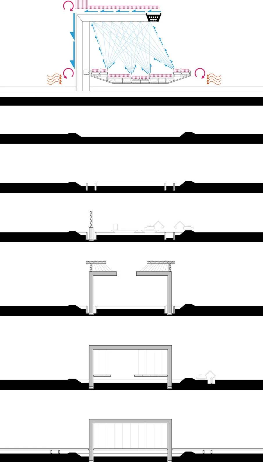
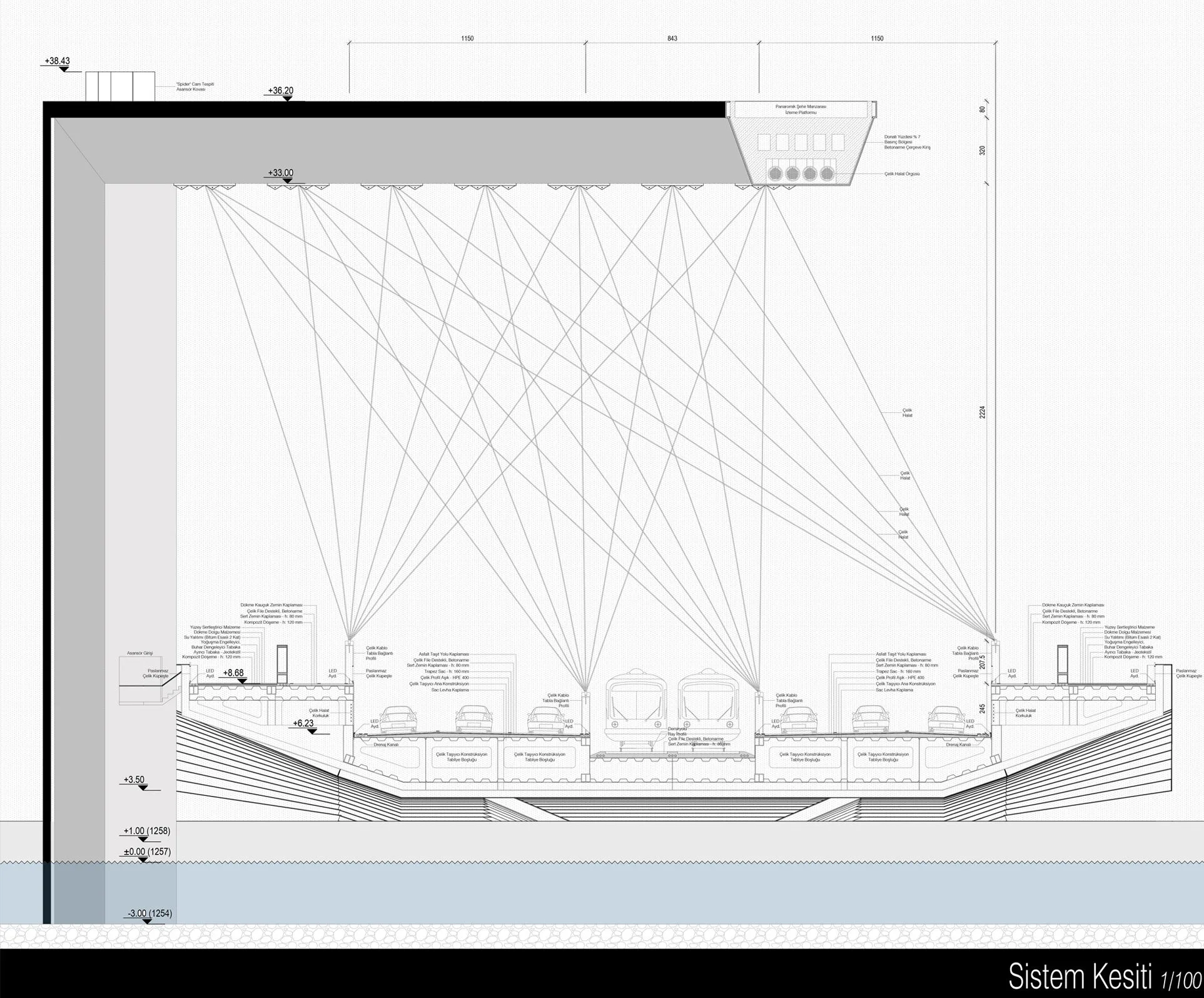

The bridge's suspended footings, strategically placed near the riverbanks, minimize disruption to the water flow and prevent alterations to the hydrological dynamics. This thoughtful design mitigates potential environmental impacts, while the inclined orientation of the suspension columns effectively dampens the hydraulic turbulence generated by the current.
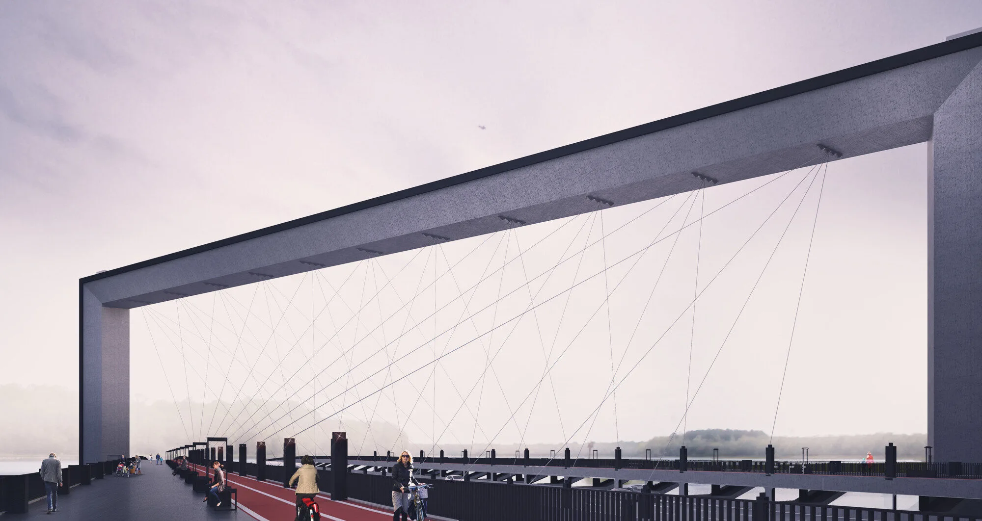
The Sivas Kızılırmak Bridge accommodates a multifaceted transportation network, including vehicular lanes, a railway, dedicated cycling paths, and pedestrian walkways. Due to the lack of sufficient data regarding the ongoing urban planning and the equal scenic orientation offered on both sides of the bridge axis, pedestrian pathways are evenly distributed, ensuring equitable access without bias toward any single direction. This equitable approach is similarly applied to the bicycle routes.

The inclination and variable angles of the suspension cables facilitate unobstructed passage for both wheeled vehicles and railway systems, as these transit types are segregated from pedestrian pathways, thus maintaining visual continuity. This spatial arrangement ensures that the pedestrian and cycling routes proceed uninterrupted, free from visual disruptions or the adverse impacts of vehicular traffic. The cantilever joint detail allows for the integration of wind corridors between the pedestrian and cycling paths and the main deck, providing structural resilience against potential resonances within the bridge structure.
