Odemis Urban Design
Odemis Urban Design
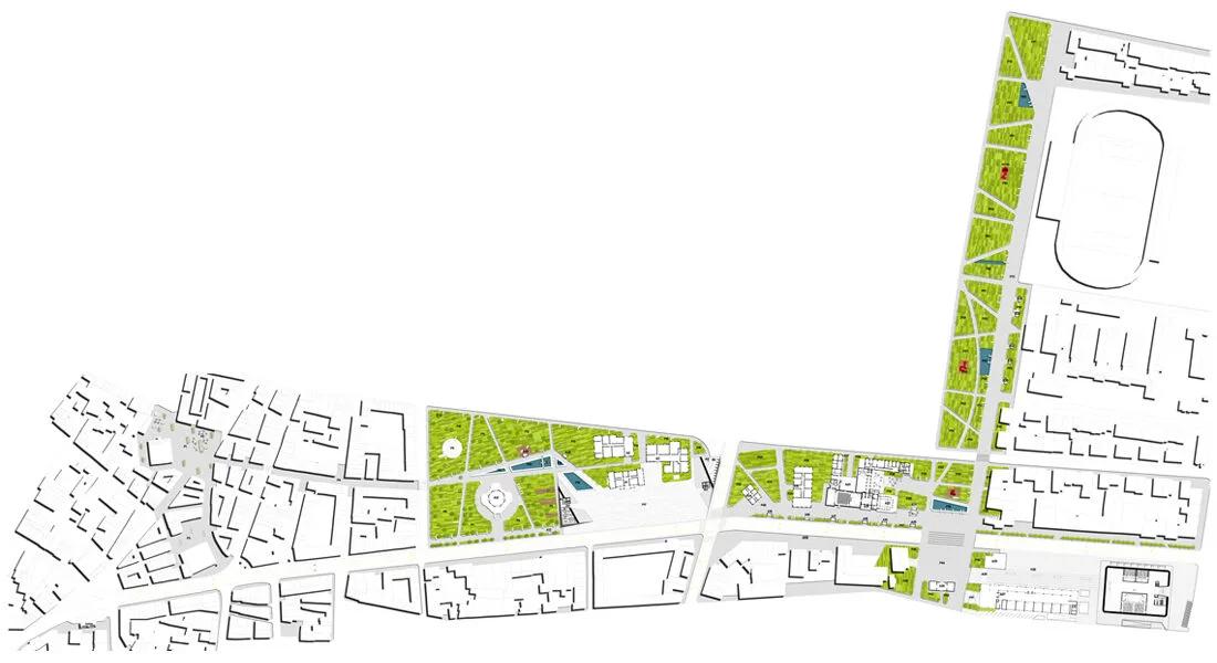
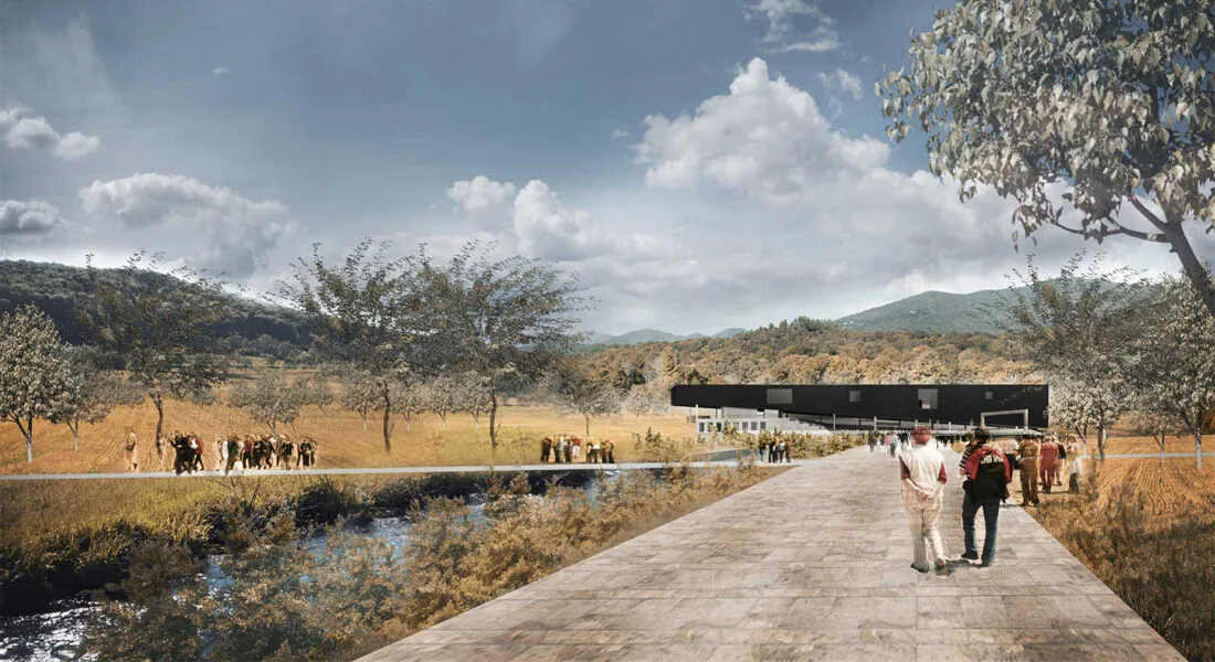
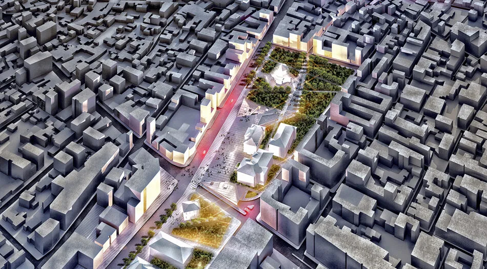
Ödemiş is a settlement characterized by its unique architectural fabric, natural beauty, topography, recreational areas, and historical context, embodying multiple urban layers. The primary structure of the project is established on the resolution of elements that disrupt the integrity of the city, aimed at revealing the potential inherent in the urban fabric. In this direction, the project proposes a "Holistic Design" approach that highlights existing historical values while delineating the development framework of the city. Accordingly, the city can be divided into four main areas, reflecting its current potentials;
1. The Historical Bazaar District (The City’s PAST): Serving as a significant center for the daily lives of residents, this area encapsulates the historical essence of Ödemiş.
2. The Government Square District (The City’s PRESENT): This district serves as the hub of public life within the competition area and encompasses one of the city’s crucial recreational spaces, Tayyare Park.
3. The New Municipality Square (The City’s FUTURE): Positioned as the new cultural and artistic center of the city, this area holds significant importance for future planning, marked by the new municipal building and the designed cultural center.
4. The Urban Interval: Concluding at the historic Ödemiş Train Station, this area, despite its inherent potentials, divides the city into two parts.
These four primary regions form the backbone of Ödemiş City. However, they fail to provide a rich urban experience for residents due to both the current uses and the inadequately integrated transportation system. Consequently, several interventions have been proposed within the project.
Odemis Urban Design
Transportation Interventions:
1. The Historical Bazaar District (The City’s PAST):
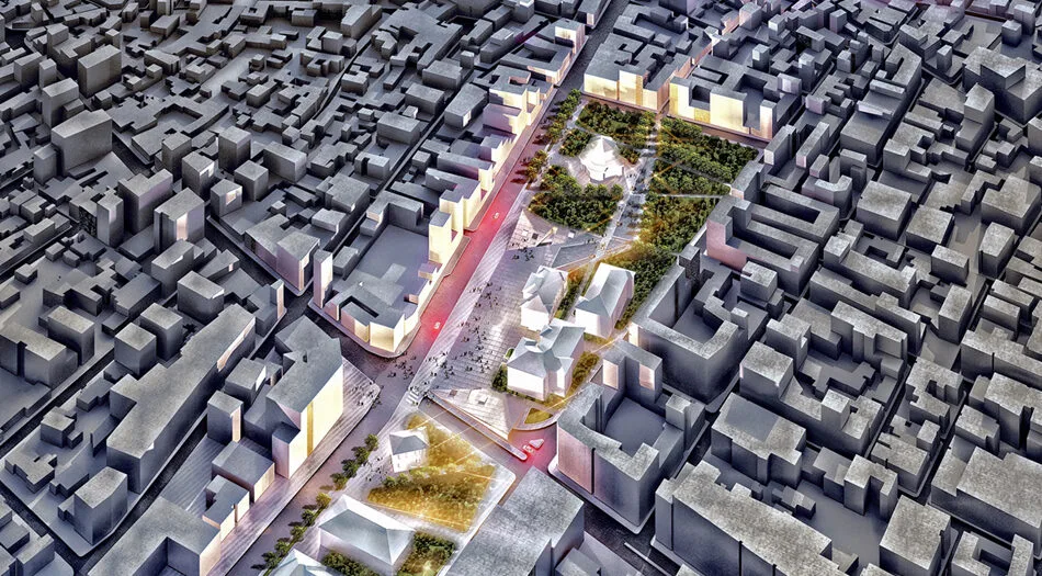
The pedestrianization interventions in the historical bazaar area are a well-placed decision aimed at uncovering the dynamics of the region. However, despite these pedestrianization efforts, the area suffers from weak connectivity to other significant urban centers. In this regard, it is envisioned that the area will be linked via an uninterrupted pedestrian promenade running east-west, connecting Tayyare Park, Government Square, and the New Municipality Square. Savaş Street and the adjacent roads, linking the bazaar area to Tayyare Park, have been dedicated to pedestrian use. This not only strengthens the significance of the Historical Bazaar in the lives of residents but also enhances the recreational potentials of Tayyare Park. Additionally, environmental and façade arrangements of historical structures within the bazaar area have been implemented to emphasize the existing historical fabric, allowing the chaotic nature of the area to give way to a tranquil and peaceful living environment.
2. The New Government Square District (The City’s PRESENT):
The arterial road passing through the periphery of the new government square constitutes the primary vehicular backbone of the city. Fatih, İzmir, and Atatürk Streets, located along this vital traffic artery, play a key role both commercially and in terms of urban density. When considering vehicle densities and urban life, Ödemiş can be termed a ‘Calm City’ that could address traffic issues through minor interventions within the existing traffic flow. It is evident that profound interventions along this main artery would complicate the city's character and development system.
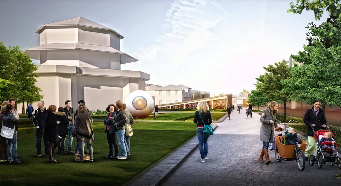
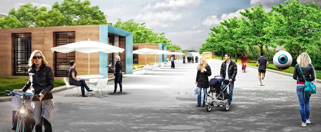
In light of this, the project reconsiders existing pedestrian sidewalk dimensions and parcel boundaries to create a pedestrian promenade that abstracts from the current traffic flow, featuring green buffer zones and urban elements. This promenade is enriched with various urban units. Furthermore, considering the prevalent potential for bicycle use throughout the city, a bicycle network that extends along the pedestrian axis and connects to multiple points across the city has been proposed.
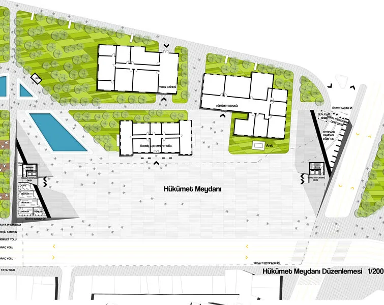
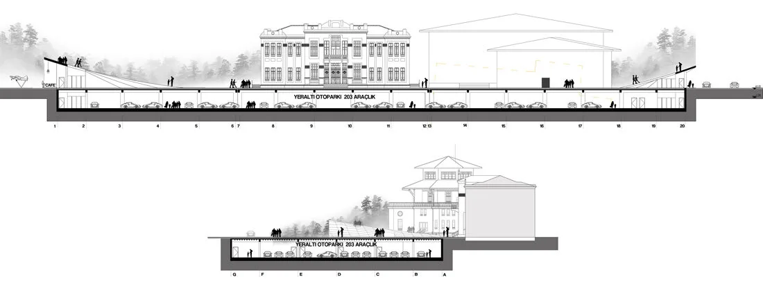
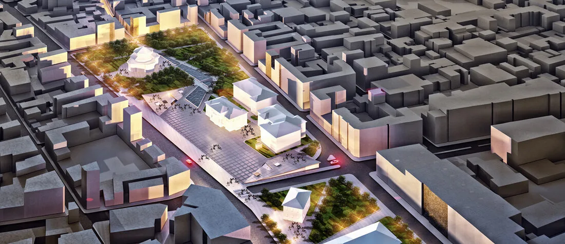
A notable issue arising from the existing uses of the Government Square is the use of parking. The current square effectively functions as an open-air parking lot. Additionally, the inability to integrate with Tayyare Park on the western edge presents another challenge. Addressing this, the project organizes the triad of Square-Parking-Social Amenities through the concept of the ‘Platform Square.’
The Platform Square proposal aims to reestablish the area as a square, free from chaos, through a contemporary and minimalist interpretation. Furthermore, it seeks to offer a new perspective on the conventional notion of a one-dimensional square. The Platform Square extends east-west while organizing the necessary spaces for the area at different elevation levels. At the intersection point of the square with Tayyare Park, the social units required for the area are created through surface movements of the platform. In consideration of vehicle densities surrounding the area, the surface movement on the northeast side of the platform square organizes entrances to an underground parking facility. Additionally, public units to be preserved within the area are emphasized through surface movements, transforming the space into a meeting point for residents.
3. The New Municipality Square (The City’s FUTURE):
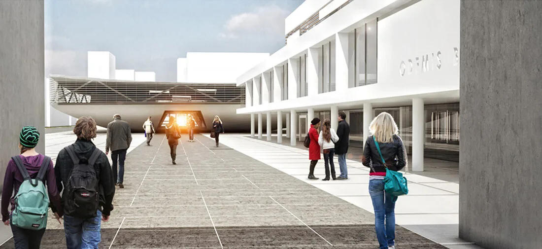
The New Municipality Square occupies a central location at the traffic junction in the city’s future vision. Traffic regulations in this area have been designed to alter the north-south traffic flow, culminating in a cohesive square design. Furthermore, existing structures to be preserved are highlighted through landscape arrangements, establishing the designed cultural center as a new reference point for the city.

4. Urban Interval (Urban Life Corridor):
This area, characterized as the most significant urban void within Ödemiş, traverses the city along the north-south axis. Structurally examined, it represents a substantial opportunity for the region due to its dense green fabric. However, due to usage problems, this area, which should serve as a meeting and recreation point for people, has become a wall dividing the city. Within the project, this area is envisioned to play a key role in the future vision of the city. Reassessed urbanistically, this area has been transformed into an urban life corridor with tranquil green spaces, landscape elements, social amenities, sports and recreation areas, a sculpture park, and walking and cycling paths. Additionally, the existing railway line has been terminated at the beginning of this axis, and a proposal for a tram line encircling the city has been introduced, starting from an information center at this point.
