Viinikanlahti Urban Design
Viinikanlahti Urban Design
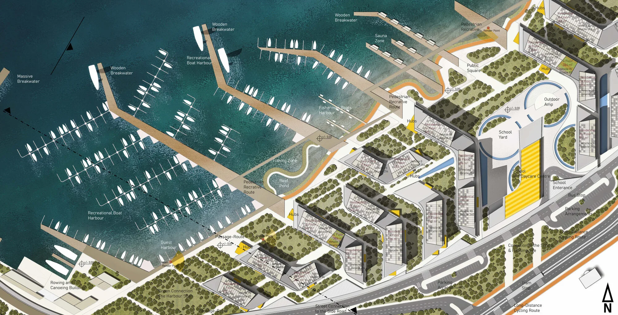
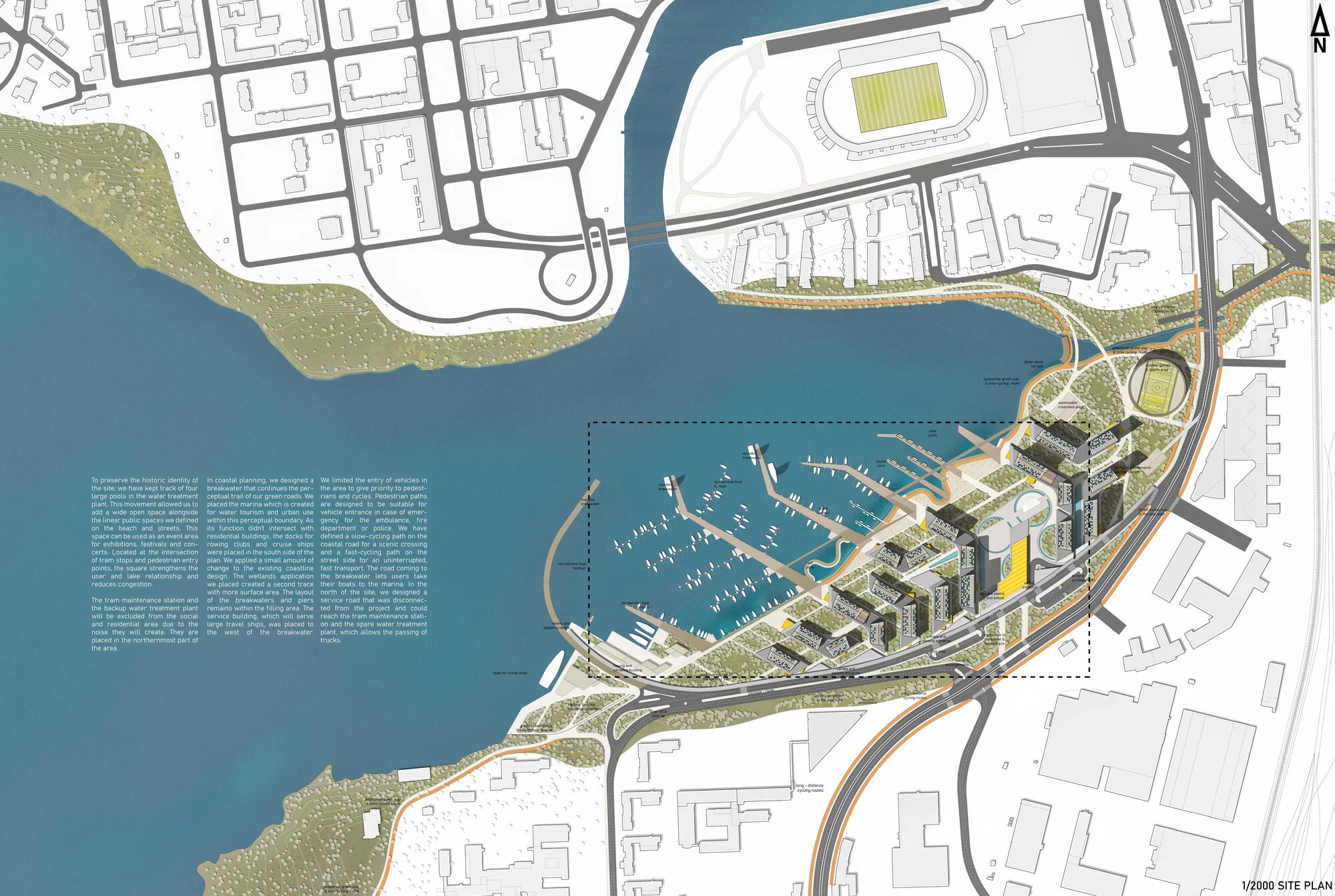
In this project, the settlement layout has been conceptualized around two primary directional axes. The first axis, oriented towards the South, maximizes sunlight exposure, thereby fostering both psychological and ecological benefits for the inhabitants. The second axis is strategically positioned to optimize the integration of the natural landscape, offering scenic vistas for the users. The resulting plan draws from these orientations, establishing a carefully organized grid system that prevents spatial overlap and maintains clarity within the development.
Viinikanlahti Urban Design
The grid layout is bounded by two significant green pathways: one along the coastline, and another bordering the highway. These green corridors serve as vital connective elements, reinforcing the relationship between the built environment and the natural surroundings. The grid's gaps are deliberately left open to accommodate the planned massing of buildings.
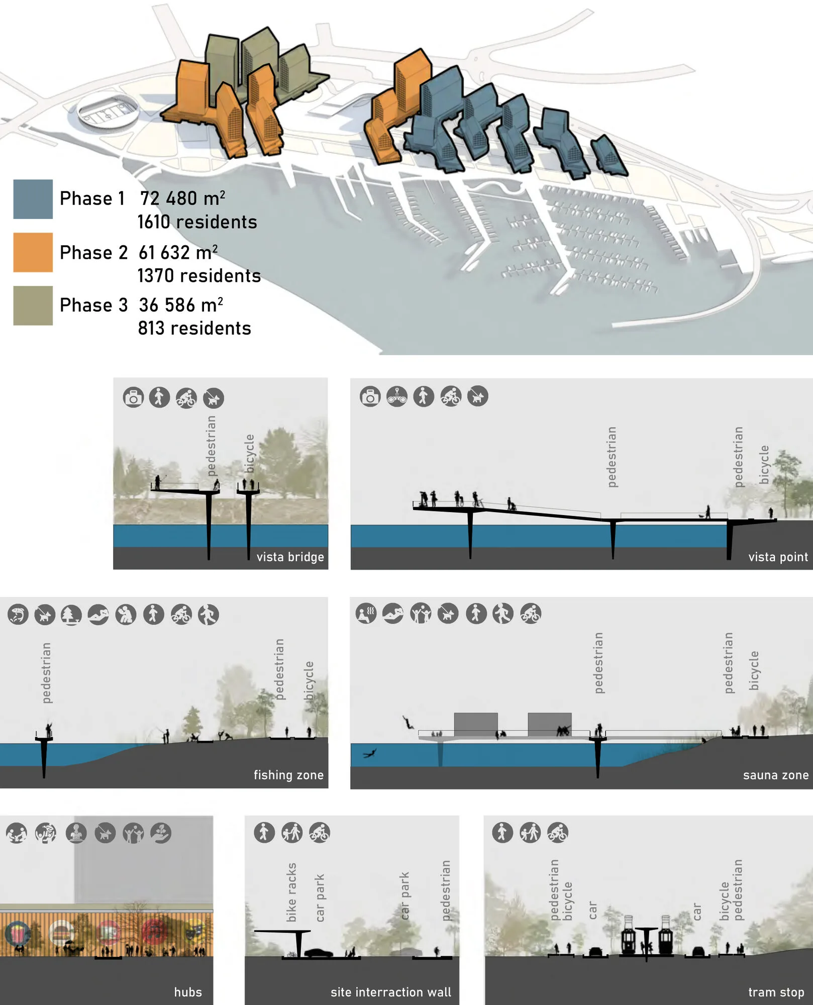
The first green corridor seamlessly connects Hatanpää Manor Park to Höyrynpuisto Park, traversing the coastline without interruption. The second green pathway, which preserves and enhances the existing vegetation along the eastern edge of the site, provides a recreational space for those who may prefer to remain outside the immediate development area. To enhance permeability, a boundary wall has been incorporated, functioning in tandem with pedestrian and vehicular pathways. This wall directs users to essential facilities, such as parking areas, while its underside accommodates parking spaces along the roadside.
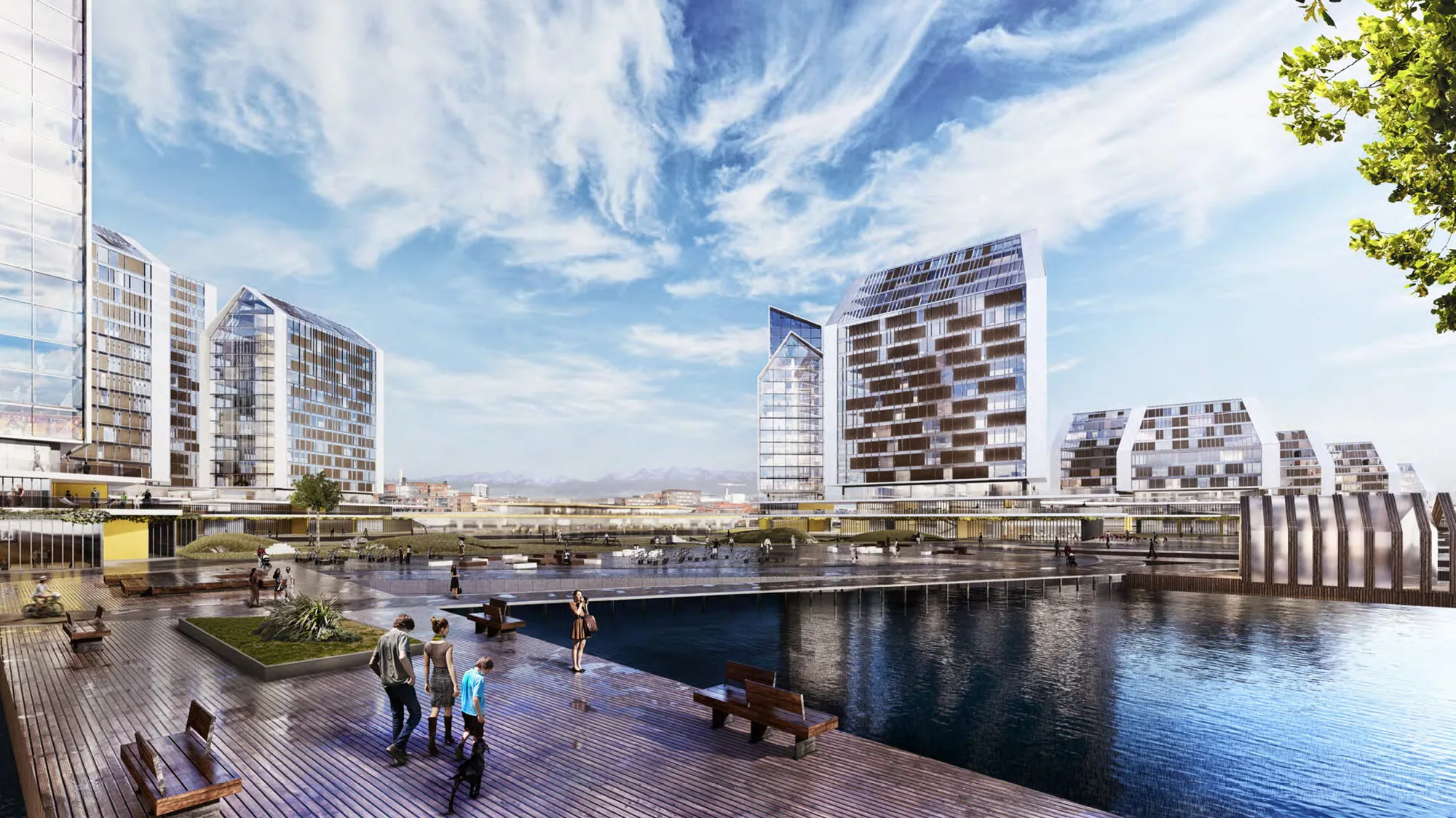
In recognition of the site's historical identity, we have preserved four large pools from the former water treatment plant, transforming them into potential event spaces. These pools, centrally located within the site's transportation network, serve to strengthen the connection between the development and the adjacent lake, while also alleviating congestion at key points.
Perceptual and Environmental Integration
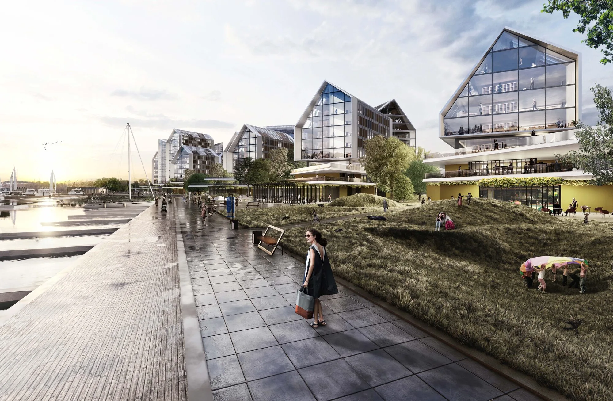
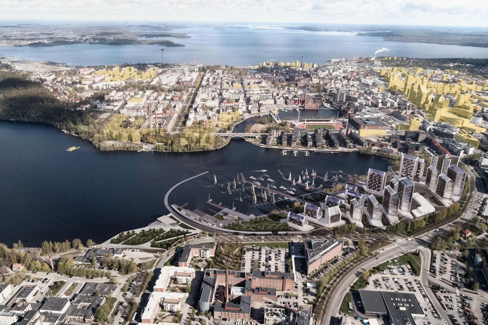
The breakwater extends the conceptual green pathways, creating a visual and spatial connection between the residential areas and the marina. Positioned to the south, the marina caters to both rowing clubs and cruise ships, with minimal interaction with the surrounding residential structures. A wetland zone, designed to enhance ecological diversity, occupies a larger area to the north, further reinforcing the site's connection to the natural environment.
To mitigate noise disruption, the tram maintenance station and backup water treatment plant have been placed at the northernmost edge of the site, away from the core residential and social zones. This strategic placement ensures that these functional elements do not impact the user experience within the more sensitive areas of the development.
Design Considerations
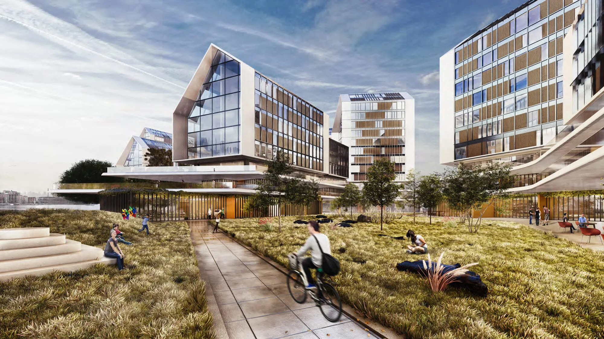
The positioning of residential buildings has been informed by the site's topography and the alignment of platforms, which serve as the primary organizing elements within the master plan. Service functions such as markets, cafés, and other community-oriented spaces are located beneath these platforms, forming a series of 'hubs' that support the street-level facade and foster urban interaction.
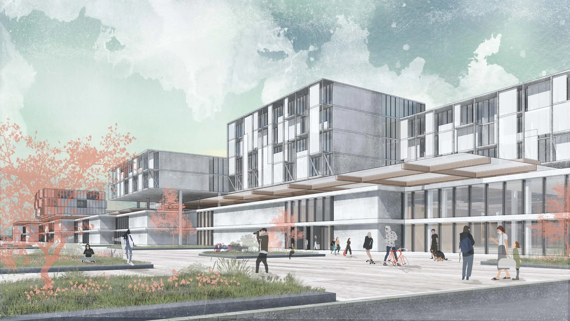
The school building is sited within the central square, benefiting from the area's extensive transportation network and its relationship to the surrounding landscape. The massing of the school building follows the trajectory of the platforms but is differentiated through a distinctive movement, allowing for a unique architectural presence.
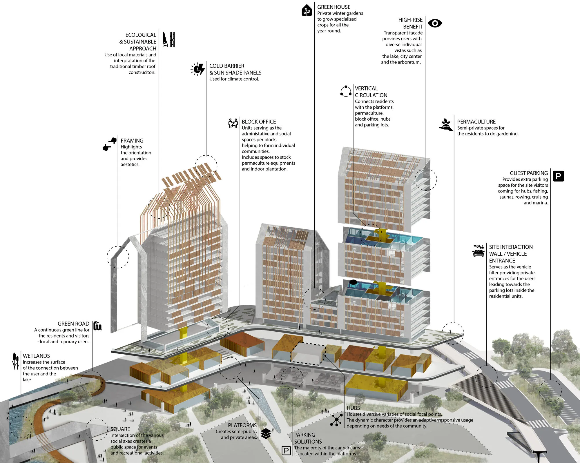
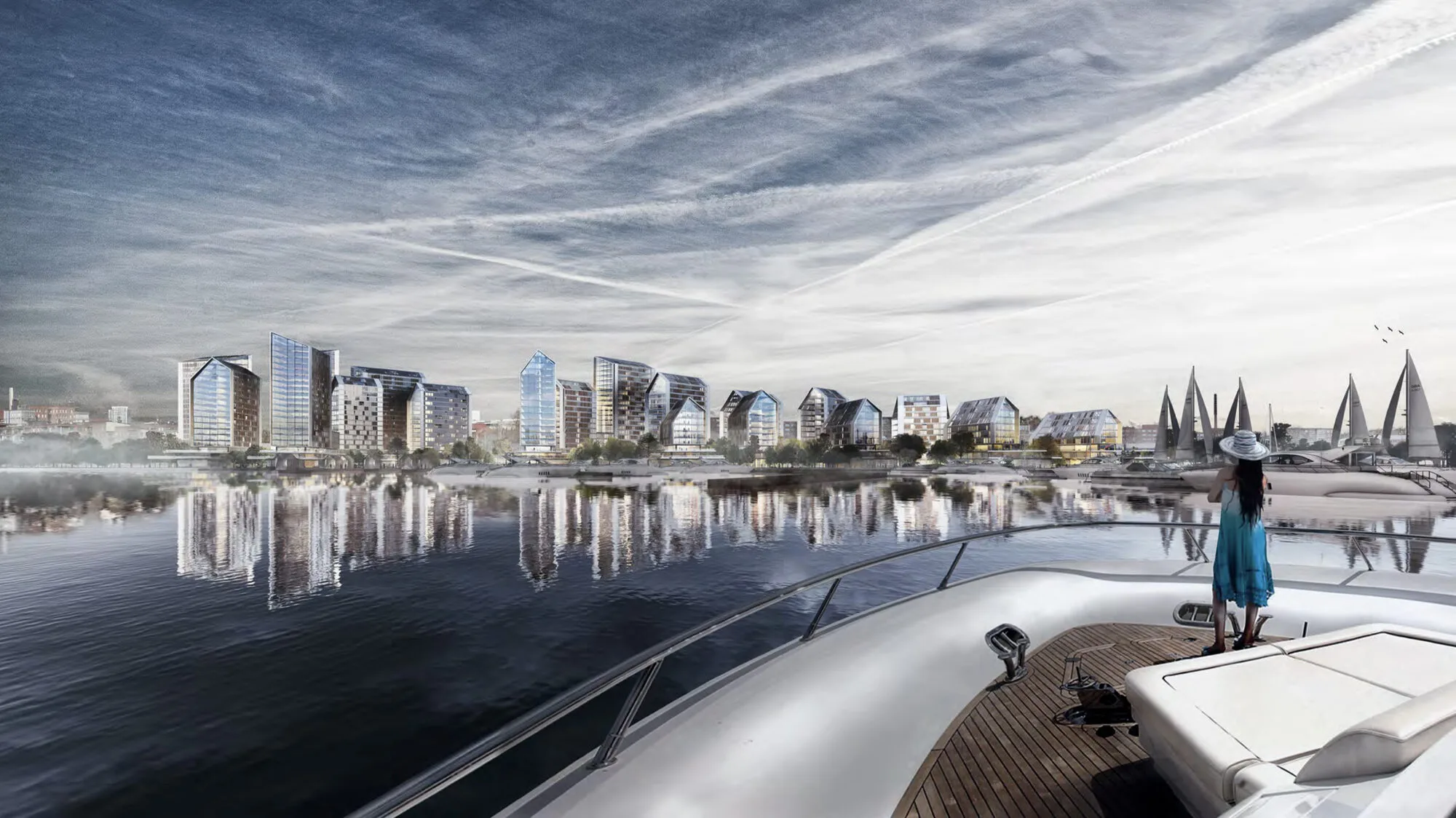
To accommodate the required density of residential units while preserving public space at ground level, high-rise buildings are strategically incorporated into the design. These vertical structures contribute to improved urban dynamics, such as facilitating smoother traffic flows, optimizing infrastructure efficiency, and enhancing service provision. The architectural treatment of these high-rise buildings, particularly their facades and rooflines, is carefully considered to contribute positively to the city’s skyline.
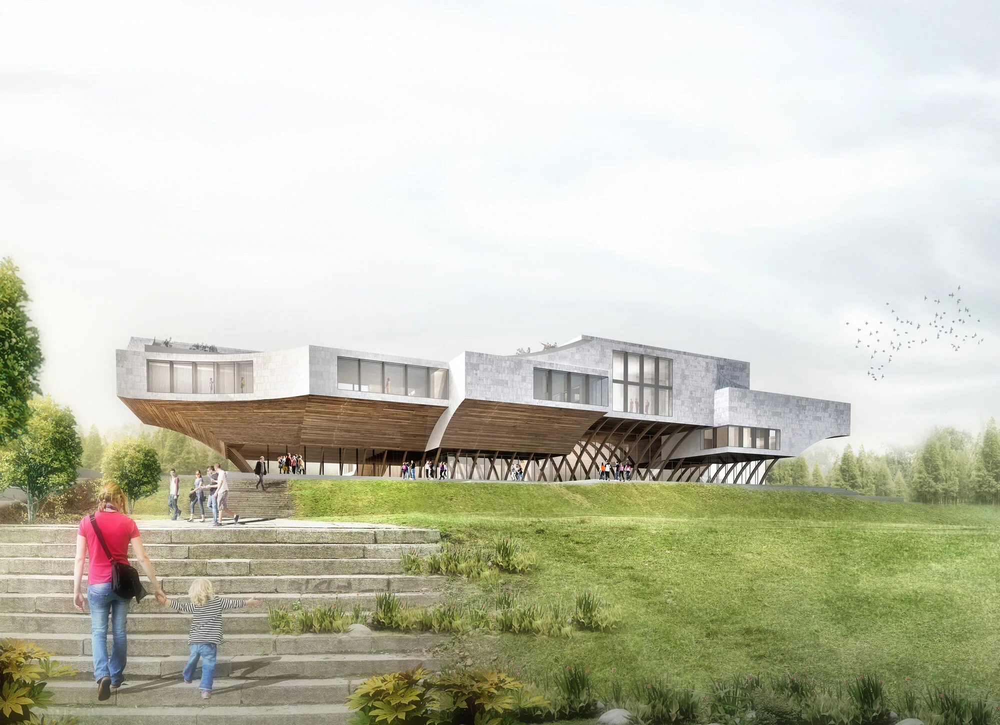
The rowing club building is designed with flexible spaces, comprising open, semi-open, and enclosed areas to meet the varied needs of a sports facility. Situated in a sheltered bay, the building fosters social interaction and provides spaces for gathering, further enriching the community’s social fabric.
Implementation Strategy
The phased implementation of the project begins with the construction of low-rise buildings closest to the coastline, followed by the high-rise structures. As the first platform and its associated housing units are completed, public, semi-public, and private spaces begin to take shape, fostering a sense of community from the outset. The platforms themselves meet their parking requirements, while additional parking spaces are provided beneath the boundary wall as the building heights increase. The second platform further strengthens the formation of social streets, enhancing the project's connectivity and vibrancy.
